APPLICATION / 01
Ditches and profiles
For a simple ditch, you can set the profile and slope directly in the system. A separate CAD file is not always needed. The operator sees the bucket position relative to the target surface.
What is it like to install the system and excavate with it? We share our experience installing FJTRION EC100 on a Volvo excavator and using G31PRO on an Estonian construction site.
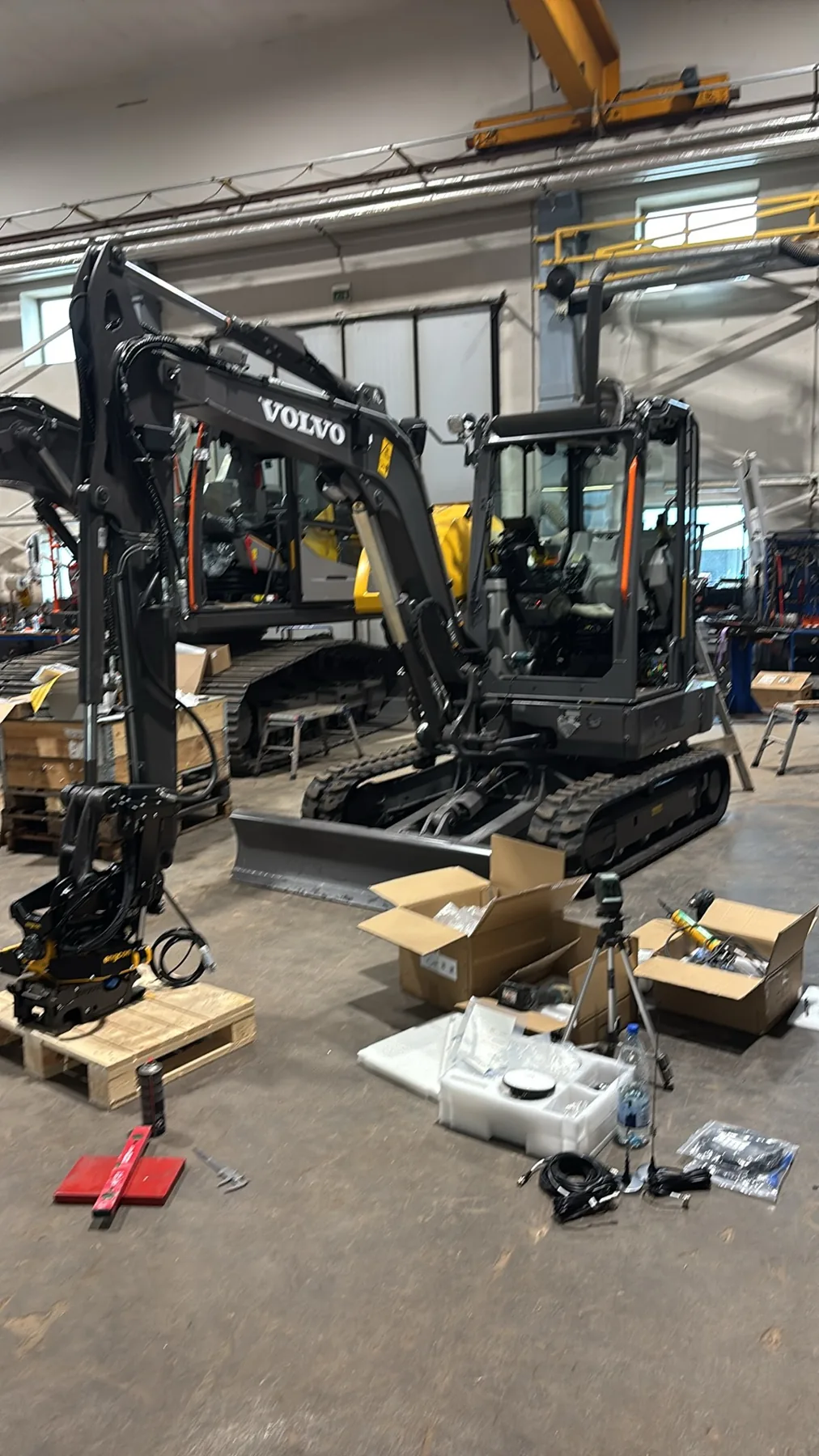
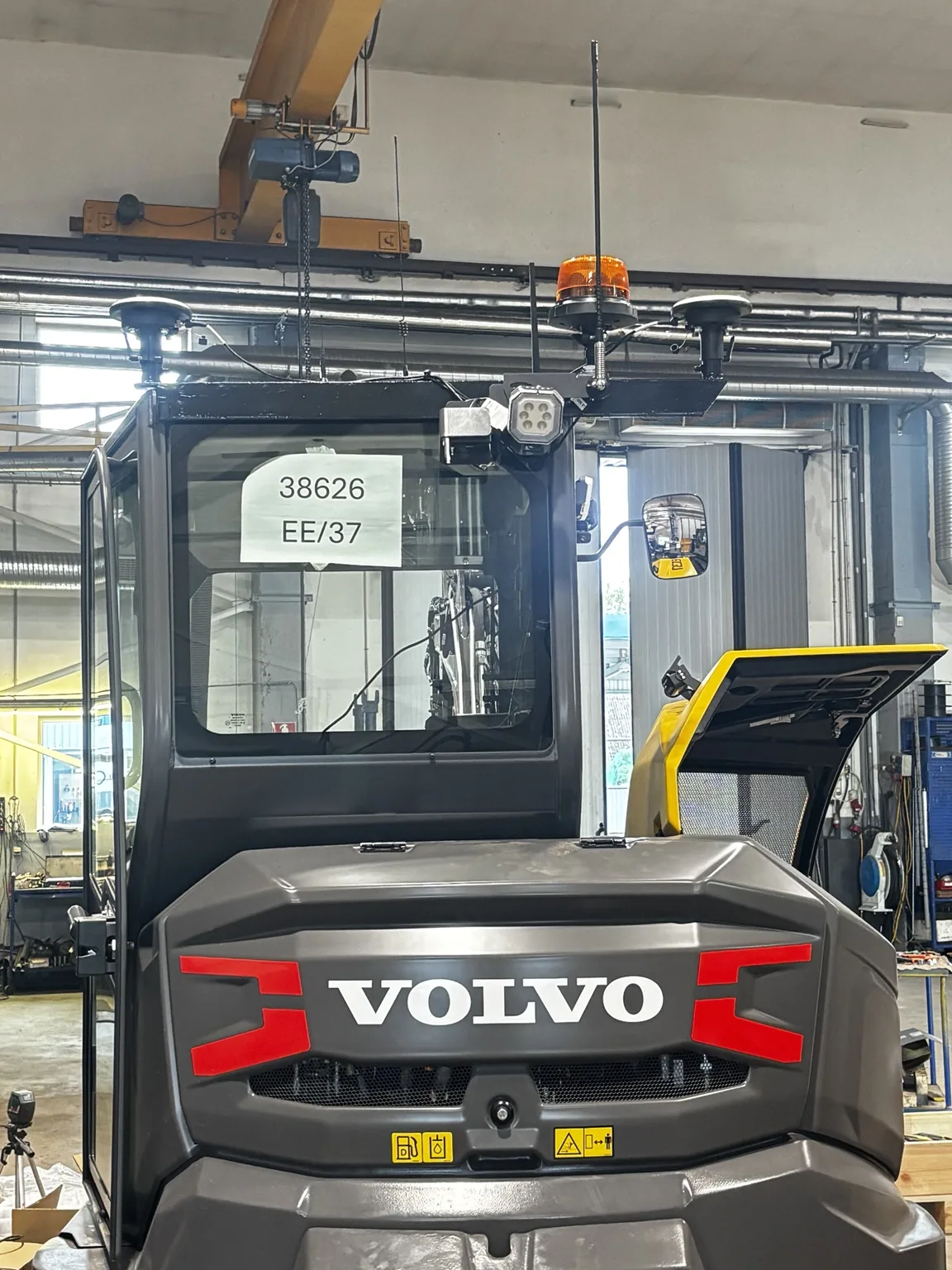
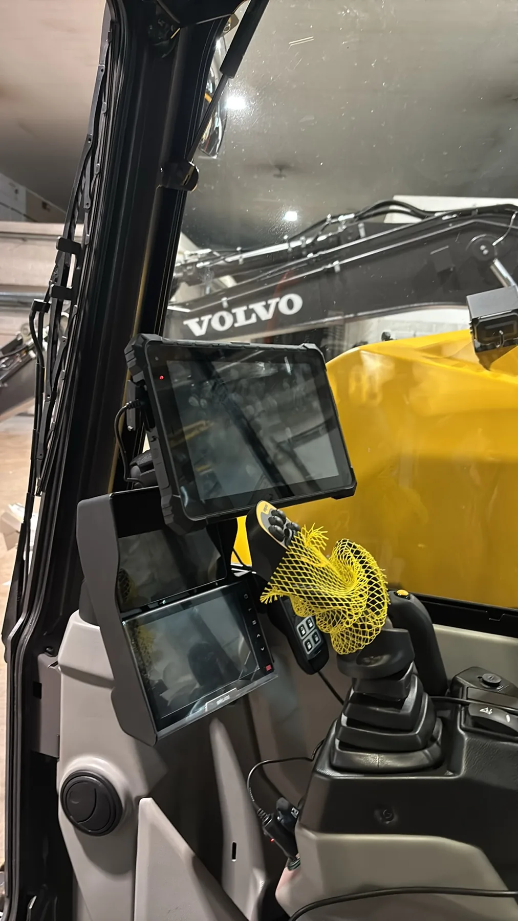
We installed an FJTRION EC100 3D guidance system on a Volvo excavator. The manufacturer's instructions, training videos and labelled connections helped us complete the work step by step.
Clearly labelled connections and detailed documentation make EC100 installation understandable. Once the control unit, sensors and tablet are connected and the app is running, the diagnostic view shows component status. · Privacy notice
You can see in real time which systems are active and which have no connection. This helps locate connection or setup errors quickly.
With a suitable interface, EC100 can read tiltrotator position data via CAN bus. For Engcon, Steelwrist and other systems, we check the specific control system, software and 3D interface compatibility.
Calibration records the boom and attachment dimensions. Measurements can be taken manually, with a total station or using GNSS/RTK. An FJDynamics rover connects to the tablet via Bluetooth and helps record measurement points.
The calibration software shows how to position the boom and bucket and what to measure. Parameters for different attachments can be saved and selected for the work being done.
Check machine geometry, sensors, attachment and positioning accuracy before starting work.
The first video shows EC100 installation. The other two show its predecessor G31PRO working on an Estonian jobsite.
These photos and videos were taken on an Estonian construction site using an FJDynamics G31PRO system. G31PRO is the predecessor to today's EC100 — this experience illustrates 3D guidance principles, although features and user interfaces can differ between models.
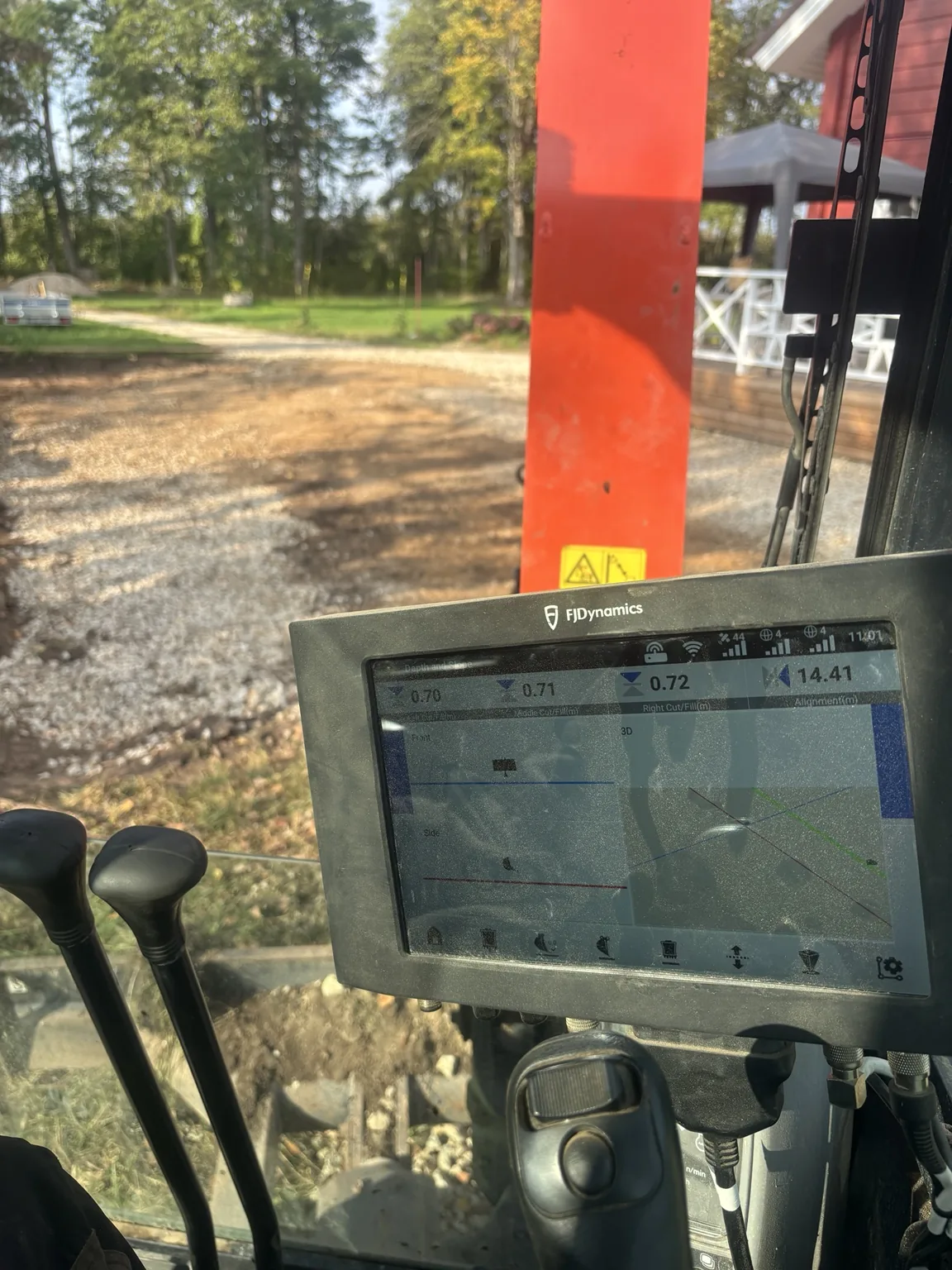
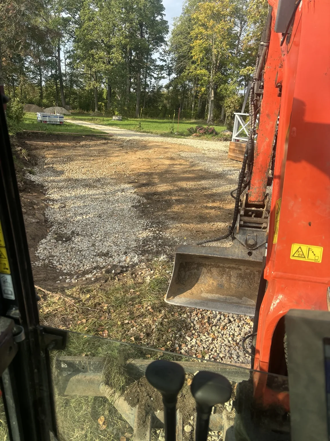
For a simple ditch, you can set the profile and slope directly in the system. A separate CAD file is not always needed. The operator sees the bucket position relative to the target surface.
The target plane and slopes can be set on the machine's display. Guidance helps excavate or grade to specified elevations and reduces the need for repeated manual measurements.
When a work location is specified by coordinates, correct system setup and GNSS positioning can locate it on the screen. This may reduce the need for additional setting-out visits.
FJTRION TerraMind is a web-based project platform. Prepare a design, send it to a supported machine and follow jobsite progress within the capabilities described in the manufacturer's documentation.
Add a suitable design file, set the coordinate system and a geoid model where required. TerraMind supports design formats including DWG, DXF and XML.
Link the design to a supported machine. TerraMind synchronises the design and updates with the device without transferring each file on a USB drive.
The portal shows project progress and estimated excavation and fill volumes. The map view compares design surfaces with surface models calculated from machine work data.
Design revision history and notifications
Machine location and status display
Reports based on project work data
Technical note: volumes calculated from work data are estimates and do not replace an official as-built survey. Based on information supplied by the manufacturer so far, export of a 3D as-built surface calculated from EC100 machine data is not supported. Features depend on device software, project and connection.
An experienced technical partner helps set the system up correctly and resolve questions after installation. We focus on practical requirements at Estonian jobsites.
Estonian construction projects require correct use of L-EST97, the EH2000 height system and, where necessary, EST-GEOID2017. We have setup experience. Results must be checked against control points before work starts.
L-EST97 · EH2000 · GeoidWith suitable software, the EC100 Android control unit supports remote diagnostics and app support. The manufacturer's DMS and, where needed, TeamViewer can help resolve setup issues without a site visit. Remote access depends on the device and requires operator consent and working internet.
Remote support option · Compatibility checkedIn our experience, 3D guidance is especially useful when following specified elevations, slopes, ditch profiles or design locations. EC100's diagnostic and calibration processes are strengths during installation.
FJTRION does not replace a skilled operator — it helps them understand where the bucket is and how much material to remove or add.
No. The installation photos show FJTRION EC100. The Estonian jobsite material shows its earlier model, G31PRO. Both illustrate our actual experience, but software and features can differ.
A suitable control system and activated 3D interface can allow tiltrotator position integration via CAN bus. Compatibility must be confirmed for the specific tiltrotator, control system and software version.
No. Simple slopes, planes and ditch profiles can also be set directly in the machine's system. Suitable design files make more sense for complex projects.
No. Guidance can reduce repeated setting out and check measurements, but official as-built surveys and independent quality checks must follow project requirements.
Send the machine make, model and year, describe its boom and tiltrotator and the work you do. We check compatibility and propose a suitable configuration.